Geography
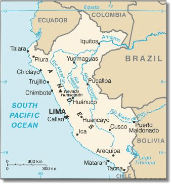
Peru covers 1,285,216 km2 (496,225 sq mi). It borders Ecuador and Colombia to the north, Brazil to the east, Bolivia to the southeast, Chile to the south, and the Pacific Ocean to the west. Peru has three main land areas: The Coast, The Highlands and Jungle.
The Coast has the largest cities and is where most people in Peru live. It is mostly desert, but is crossed by more than 40 rivers that run down from the Andes Mountains. These rivers provide people with the water necessary to grow crops such as cotton, rice, and fruit on the irrigated land. Sugar, wine, pisco, and metallic minerals are important products from this area.
The Highlands in the Andes Mountains has tall peaks and steep valleys and its main goods of are potatoes, cereals, and vegetables. People there make a living by cattle-raising, mining, and weaving.
Peru’s third important area is called the Jungle. It is a thick tropical rainforest that grows near the waters of the Amazon River below the eastern slopes of the Andes. The largest city in the Selva is Iquitos with an estimate population of 400,000. However, the only way to travel to Iquitos is by air or by boat up the Amazon river. Most of the thousands of types of plants and animals in the rainforest here were not widely-known until recently. This region produces wood, rubber, rice, fruit, coffee, tea, petroleum, and natural gas.